Anyone who has spent time with the old survey maps of this stretch of the Murrumbidgee will have noticed it: Toganmain has a neighbour whose name shifts depending on which document you are reading. It appears as Jingorambah in 1848, and as Singorambah on every parish map since. Neither spelling shows up in any Wiradjuri dictionary or language-revival record, which makes the discrepancy less a mystery to solve than a small window into how colonial surveyors put pen to paper.
The Dual Name Entry (1848)
The earliest official record of the run appears in the New South Wales Government Gazette of 30 September 1848 (Supplement No. 111, page 1351, entry no. 118). There, Alexander and George Macleay registered their 192,000-acre run along the south bank of the lower Murrumbidgee under the joint heading “Toganmain, (Jingorambah.)”
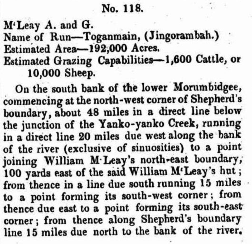
The parenthetical styling is worth pausing on. It suggests Toganmain and Jingorambah were understood at the time as two names for the one property holding, or as two adjoining localities inside the Macleays’ broad squattage, rather than as a run and something entirely separate.
Thomas Robertson and the Dropping of Jingorambah
Following the Macleay era, the run was acquired by Thomas Robertson in the late 1850s and 1860s. Robertson consolidated and ran the now-massive property strictly under the single name Toganmain, dropping Jingorambah entirely from station branding, wool clips, stock returns and private correspondence.
That commercial preference is almost certainly why Jingorambah disappeared from everyday regional usage and from the surviving station archives, living on only in the state’s own survey ledgers — a name kept alive by bureaucracy alone, long after the people running the place had stopped using it.
Emergence of “Singorambah” (Parish Gazettal)
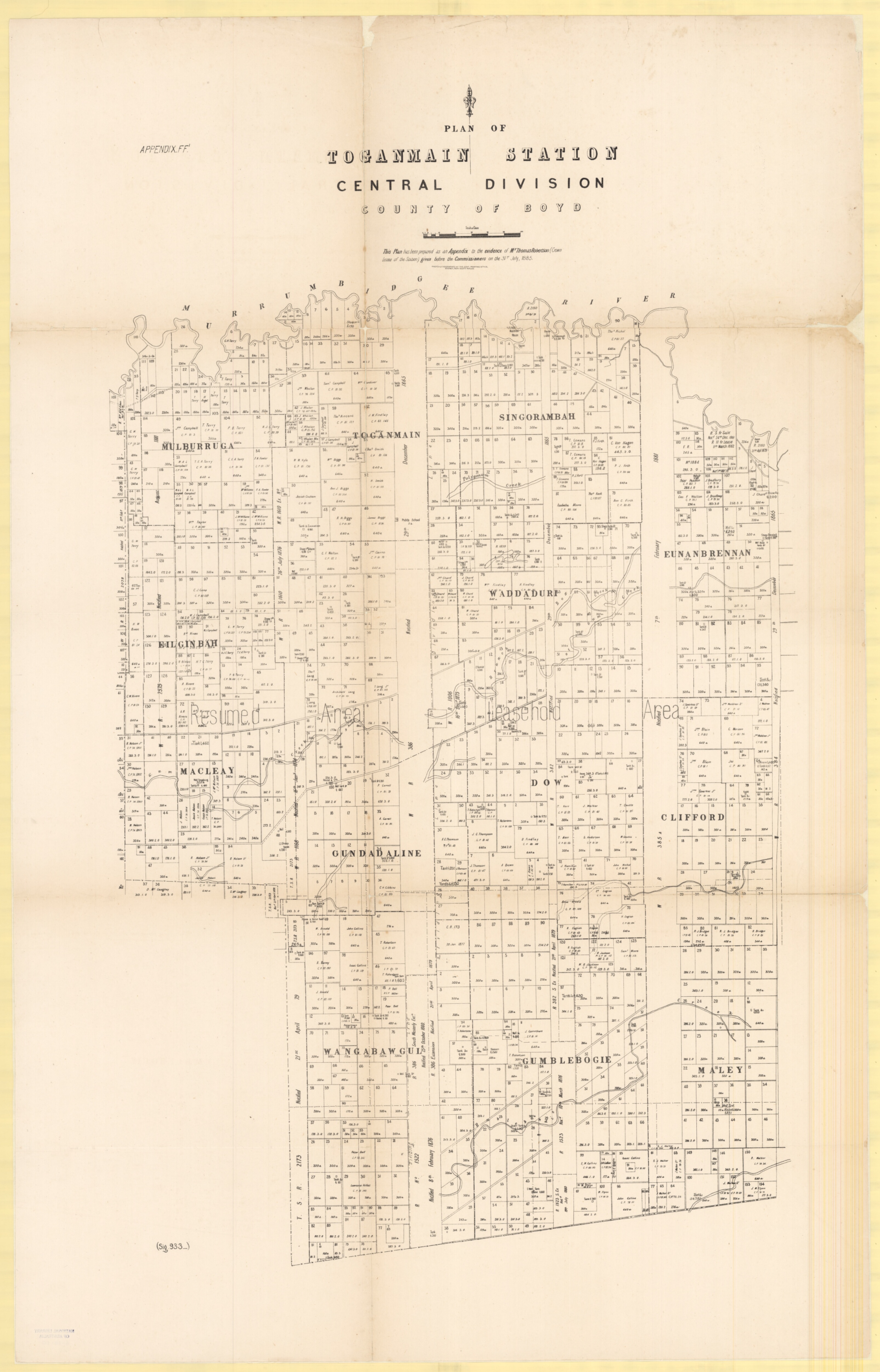
By the time the administrative cartographers got hold of it, the name had changed shape. On later survey maps — the 1907 County of Boyd map among them — it is recorded with an S, as Singorambah. This was no longer a property name at all: the Department of Lands had designated Singorambah as the official title for the parish sitting directly east of the Parish of Toganmain.
Once a name is locked into a gazetted parish title on the state’s copperplate survey maps, it tends to stay locked in. The S spelling has sat in NSW land records and titles ever since, quietly outliving the J it started with.
Linguistic and Transcription Analysis
Neither Jingorambah nor Singorambah turns up in any documented Wiradjuri language-revival database, dictionary or regional linguistic survey. That absence is itself informative. Traditional Wiradjuri phonology has no native initial English /dʒ/ (“J”) or /s/ (“S”) sound, so a consonant of that kind at the start of an early colonial place name is usually a European attempt at transcribing something else — not a Wiradjuri sound rendered faithfully.
Wiradjuri does include an initial palatal stop, often written as dj or ty, sitting somewhere between an English “J” and a soft “S” or “Ch”. Surveyors taking down placenames spoken by local Aboriginal guides routinely rendered that same sound with different English letters depending on who was listening and who was writing. The gap between the 1848 “J” gazettal and the later “S” parish map most likely comes down to exactly that — different surveyors hearing the same sound differently — or to a simple clerical slip, with a capital J and a capital S easily confused in nineteenth-century cursive when field notes were copied into the state registers.
Current Historic Status and Meaning
While the station itself consolidated under the name Toganmain, the popular explanation of what the word actually means — “I am cold” — is worth flagging clearly for what it is: unverified local oral tradition, not a linguistically proven translation. It is a nice story, and it may well be right, but nothing in the documented record confirms it.
Singorambah, meanwhile, persists purely as a historical geographic and cadastral marker — the parish name gazetted alongside Toganmain in the County of Boyd, a quiet trace of the same name the Macleays wrote down in 1848, spelled the other way.